|
FLOOD PLAINS
The Brisbane River runs through Brisbane City and is an iconic feature. Having the city built around a portion of the river does not come without consequences as Brisbane and surrounding areas are prone to flooding. The following maps will focus on the CBD area. This first map shows the areas that have a high likelihood of having a flood in one lifetime (70 years). There is a 5% chance that a flood of this size or larger can occur at any year. 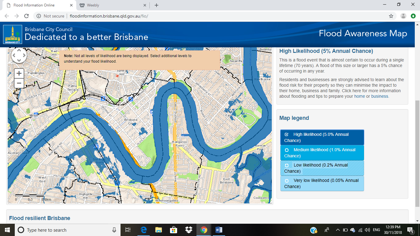
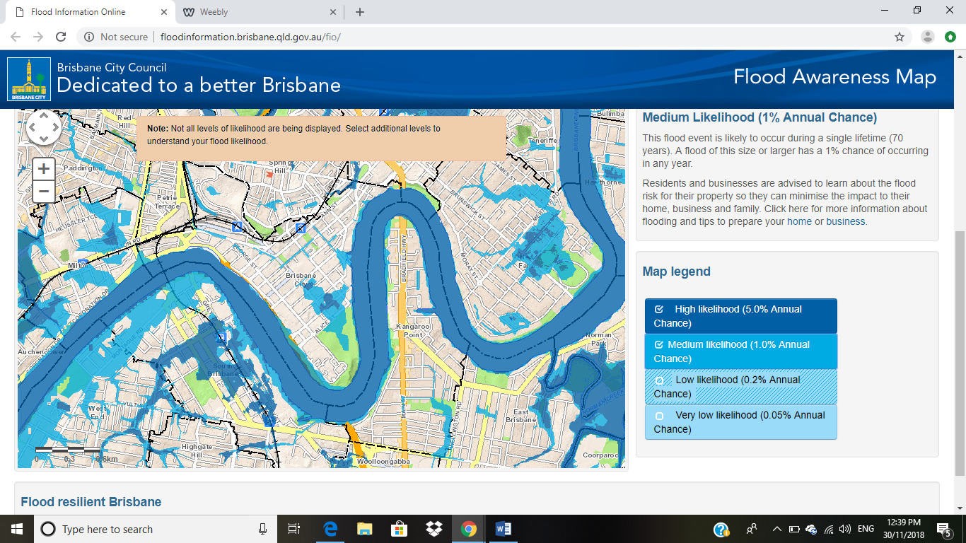
The second map highlights the medium likelihood that a flood (shown in blue) will occur in a single lifetime. There is a 1% chance this type of flood will happen in any year.
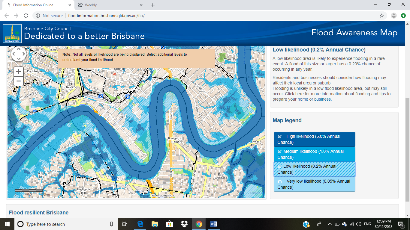
This third map shows us the low likelihood flood plains. This would be a rare event , a 0.2% chance of happening in a lifetime.
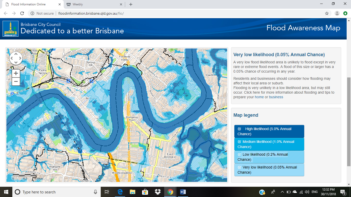
The last map highlights a very low likelihood of a flood occurrence. The areas shown in the lightest blue would only occur in a very rare or extreme flood event. There is a 0.05% chance this will happen in any year.
The portion of the map I chose is a very populated area. Like many others cities that are built around rivers, Brisbane City Council is aware of flooding potential and has strategy plans in place. The newest plan is the FloodSmart Future Strategy 2012-2031.
SOILS Brisbane and the surrounding areas have many different types of soil. The Brisbane River is Prairie soils with some sandy alluvial soils.
Click to set custom HTML
0 Comments
Invasive species are a threat to most ecosystems. The term describes a species that is: 1) non-native (or alien) to the ecosystem under consideration and. 2) whose introduction causes or is likely to cause economic or environmental harm or harm to human health. (USDA) With the world being so connected there are more opportunities for invasive species to be introduced to new habitats. I took a deeper look at an aquatic invasive species, the Kariba Weed.
I have created a slideshow that highlights dendrology occurring along the Brisbane River and in other parts of Queensland. There are many types of mangroves in the area, so I have decided to make them the focus due to their importance in stabilizing soil and providing shelter to juvenile wildlife. Please enjoy the slideshow here.
Brisbane has experienced many documented floods since the 1800's. Have a look at the most significant floods here.
I have done a slideshow of the Brisbane River map features.
https://docs.google.com/presentation/d/1CT5gjq3l5im6z5T27-AX7o28lx-Z2Bc7zebBA64_wfo/edit?usp=sharing |
Brittany CouperMaster of Natural Resources student at Virginia Tech ArchivesCategories |
 RSS Feed
